

Woodland for sale
Key information
Property description & features
- Tenure: Freehold
A scenic area of mature mixed broadleaf woodland in a coastal location close to Broad Haven, Pembrokeshire.
*28.37 acres of woodland.
*A mixture of broad leaf trees in the main including scrub with some semi-ancient trees.
*Trees present include Ash, Sycamore, Hazel, Blackthorn, Hawthorn, Birch, Beech, Holly and Sweet Chestnut.
*There are about 15 native all naturalised species and approximately 20 ornamental species of trees.
*Land is slopping in nature with a south eastern aspect.
*Stream running along the eastern boundary.
*Rich in natural habitat.
SITUATION
The land is located to the north of the coastal village of Broad Haven and south of Haroldston West. Broad Haven is located on the scenic St Brides Bay coastline and is popular for its long sandy beaches and rock pools. There is a village shop, pub and other local services within Broad Haven. Further amenities are available in the market town of Haverfordwest, being some 6 miles or so east.
DIRECTIONS AND ACCESS
From Haverfordwest, head west on the B4341 towards Broad Haven. From the Pay-and-Display PCNPA car park, continue on foot, past the Youth Hostel and HM Coastguard Station, until the footpath forks. Proceed on the footpath on the left-hand side, though a gateway which will lead to a
junction. Take the footpath ahead , through a wooden gate and proceed along the footpath (the stream should be located on the left hand-side and Broad Haven Holiday Park on the right) and across the wooden bridge. The property begins through the second wooden gate. Section of this rouse is permissive path.
The land may also be accessed over land forming part of Haroldston Farm via a “right of way at all times with or without vehicles for the purpose of management of the retained land and collection of timber therefrom or any other forestry occupations connected therewith between the point A and B” on plan. This access has been previously used to manage the woodland and it has been courtesy to agree access with the farm in advance.
The land also has a footpath access from the north including area of permissive path.
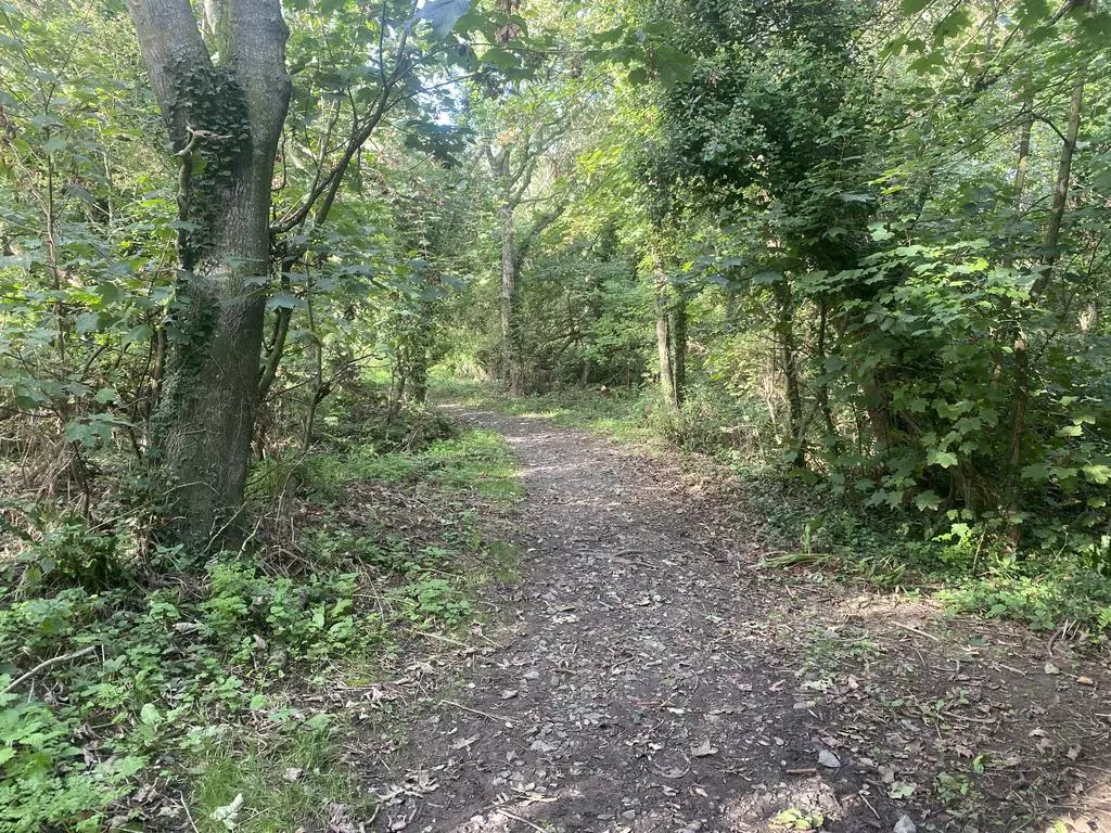
DESCRIPTION
The woodland extends from the north of Broad Haven Holiday Park to the south of St Madog’s Church, Haroldston West and is enclosed within one ring-fenced enclosure extending to approximately 28.37 acres.
The woods are prominent in the Broad Haven landscape and are well sheltered from the Atlantic.
The woodland is very diverse and includes a mixture of broadleaf trees in the main and scrub. The trees present includes ash, sycamore, hazel, blackthorn, hawthorn, birch, beech, holly, crab apple, wild pear, birch, rowan and sweet chestnut. There are approximately 15 native or naturalised species and circa. 20 ornamental species of trees. The understory, though dominated by bracken and briars under the mature woodland, is species rich and there are prominent clumps of ferns throughout. We understand no timber has been removed.
There is an area classified as semi ancient oak/ash woodland, which has a high conservation value, as well as willow carr with a tall fen vegetation association. Most of the steep wooded valley side is ash or sycamore and the flatter valley floor wetter areas of ash and willow.
There are alder, ash copse and turkey oak trees towards the north of the land. Below this area, there is an old orchard including apple trees and damsons.
In the central section of the property, the land slopes with an eastern aspect, which is planted with predominantly ash and sycamore, with some birch. Further south, there is an acre or more of hazel coppice and some ash. There is a built track, which has an area of dry heath planted below with native wildflowers, holly, blackthorn and horn.
Where the track levels, there is an extensive area of hazel and willow. To the south, there is a small plantation area of beech and a larger area of ash and sycamore. There is a stream running along the southern eastern boundary of the land which exits to the south of the Timber Hill Lodge. The land is sloping in nature with an eastern aspect.
At the southern end, there is a large area of mature ash, with semi-ancient oak underplanted with beech and other ornamental specimens and trial conifers underplanted. There is a large triple stump from a sweet chestnut with the replacement planted alongside in late 1990s. On the steep western valley, the trees are predominantly mature ash, including self-regenerating areas, At the top of the valley side, there are hawthorn and blackthorn. The valley floor itself is mostly willow, hazel and regenerating ash, with mature ash. Adjacent to the stream, there is an area of large ornamental species of trees. The land does not appear to be registered with the Land Registry and is subject to a Public Path Creation and Dedication Agreement.
WOODLAND HISTORY
It is very likely that there was occupation here going back to Neolithic times. One flint has been found during path building. There is a mound in the valley bottom which may be a tumulus. The woods were originally formed part of the Kensington estate and used for hunting in the 19th century, with some farm woodland management. There is an area of about 1.5 acres of old hazel coppice, which was managed for hazel hurdles for fencing up to World War 2. Modern plantings were mostly undertaken between 1983-1990. These were mainly a mixture of plots of native plantings of beech, ash and alder. Additionally, some 30 ornamental species were planted. These range from Turkey Oak, American Red Oak, Wellingtonia, Coast Redwood and Dawn Redwood. There are approximately 250-300 of these ornamental individual trees, which were interplanted within the native trees. Several memorial trees have also been planted, and there were Blue Peter trees planted by the local school in the mid 1980s.
TENURE AND POSSESSION
The property is offered freehold and vacant possession will be available upon completion.
EASEMENTS, RIGHTS OF WAY AND WAYLEAVES:
Please refer to the deeds for the property. It is understood that a sewer line may run through the property.
BASIC PAYMENT SCHEME ENTITLEMENTS
The Basic Payment Scheme (BPS) Entitlements are not included with the land.
SPORTING, MINERAL & TIMBER RIGHTS
All sporting, mineral and timber rights will be included with the freehold, as far as they are owned.
SERVICES
There is no water supply connected to the property.
DESIGNATION
The woodland is located within the Pembrokeshire Coast National Park Authority. The site includes areas which are designated as registered ancient woodland.
STATUTORY AUTHORITIES
Pembrokeshire Coast National Park Authority, LlanionPark, Pembroke Dock, SA72 6DU.
Telephone:[use Contact Agent Button].
Welsh Government (Agricultural Department), Picton Terrace, Carmarthen, SA31 3BT.
Telephone:[use Contact Agent Button].
National Resources Wales (NRW), Customer Care Centre, Ty Cambria, 29 Newport Rd, Cardiff, CF24 0TP.
Telephone:[use Contact Agent Button].
METHOD OF SALE
The property is offered for sale by Private Treaty as a whole.
VIEWING ARRANGEMENTS
Strictly by appointment only with the selling agent.
VENDOR’S SELLING AGENT:
Edward H Perkins Rural Chartered Surveyors, St John House, Salutation Square, Haverfordwest, Pembrokeshire, SA61 2LG.
Telephone:[use Contact Agent Button]
[use Contact Agent Button]
If you have any enquiry regarding the woodland, please ask to speak to Laura Evans.
AGENT’S COMMENTS
Haroldston Woods is a wonderful piece of woodland, being rich in nature and located in a scenic location. As well as the wide diversity of trees, I witnessed several species of birds and small creatures, whilst walking through the woodland. Viewing this piece of woodland offered tranquility and was a pleasurable day out of the office. Must be seen to be appreciated.
The property is ideal as a conservation project or for amenity users or those wishing to acquire small parcels of land as a long-term investment.
OS GRID REFERENCE
SM86501482
WHAT 3 WORDS LOCATION
PLANS AND PARTICULARS:
The information and plans provided within these sale particulars have been prepared for the convenience of prospective purchasers. Although they are believed to be correct, they do not constitute any part of an offer or contract. Statements made within these sale particulars are made without any responsibility on the part of the vendor or their appointed Selling Agent, and any intending purchasers must satisfy themselves by inspection or otherwise as to the correctness of these statements made and contained in these particulars.
Plans are provided for identification purposes only.
Property information from this agent
Places of interest
See more properties like this:
*DISCLAIMER
Property reference H222069. The information displayed about this property comprises a property advertisement. OnTheMarket.com makes no warranty as to the accuracy or completeness of the advertisement or any linked or associated information, and OnTheMarket.com has no control over the content provided by the agent or developer. This property advertisement does not constitute property particulars. The information is provided and maintained by Edward H Perkins Chartered Surveyors - Haverfordwest.
OnTheMarket may have applied supplementary data to this property listing, including:
Broadband availability and predicted speed
Broadband speed is measured in megabits per second, with the number returned showing how fast the connection is. Each reading is based on the highest predicted speed of any major broadband network for services that deliver the download speeds. The following are the different readings that we may display:
Basic: Up to 30 Mbit/s
Super-fast: Between 30 Mbit/s and 300 Mbit/s
Ultra-fast: Over 300 Mbit/s
The data is updated three times a year. The checker results are predictions and should not be regarded as guaranteed. For more information, see: https://checker.ofcom.org.uk/en-gb/about-checker#Answer_0_2
Mobile phone signal availability and predicted strength
Mobile signal predictions are provided by the four UK mobile network operators: EE, O2, Three and Vodafone. Predictions can vary significantly from the coverage you may actually experience as a result of local factors (especially terrain). Ofcom has tested the actual coverage provided in various locations around the UK to help ensure that these predictions are reasonable. The values shown against a property can be broken down as follows:
Clear: No bars, no signal predicted
Red: One bar, reliable signal unlikely
Amber: Two bars, may experience problems with connectivity
Green: Three bars, likely to have good coverage and receive a data rate to support basic web services
Enhanced: Full bars, likely to have good coverage indoors and to receive an enhanced data rate to support multimedia services
Energy Performance data and Internal floor area
Any supplementary data should not be relied upon as forming part of any property particulars and OnTheMarket cannot be held responsible for any incorrectness in this data. See here for more information.