Popular
Total views: 2500+

 Floorplans (
 Area stats
Offers over
£355,000Land for sale
Rowley Bank Lane, Knutsford WA16
Recently added
Land
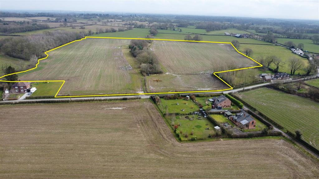
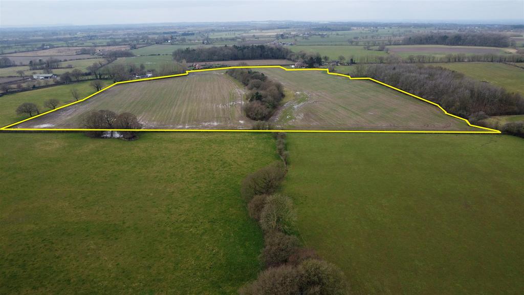
25.36 acre(s)
Key information
Tenure: Freehold
Council tax: Ask agent
Features and description
- 25.36 acres (10.26 hectares) available as a whole or in up to 2 Lots
- Lot 1 – 12.24 acres
- Lot 2 – 13.12 acres
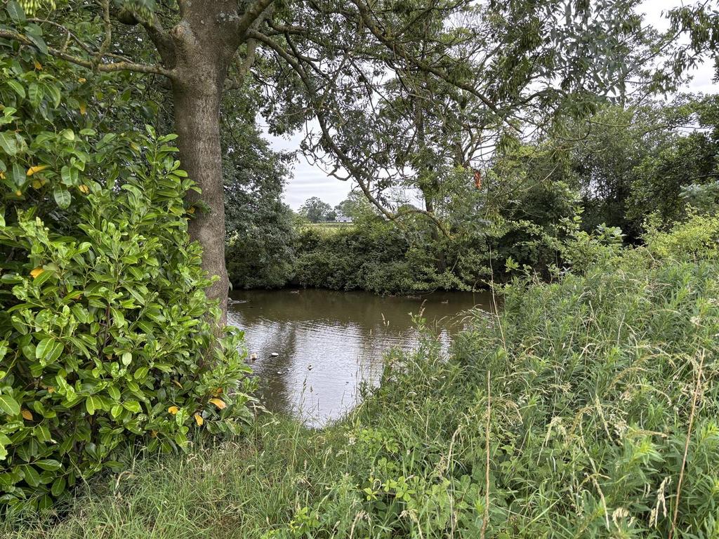
- Grade 3 arable land with woodland and ponds
- Freehold
- Available as a whole or in up to 2 Lots
Location
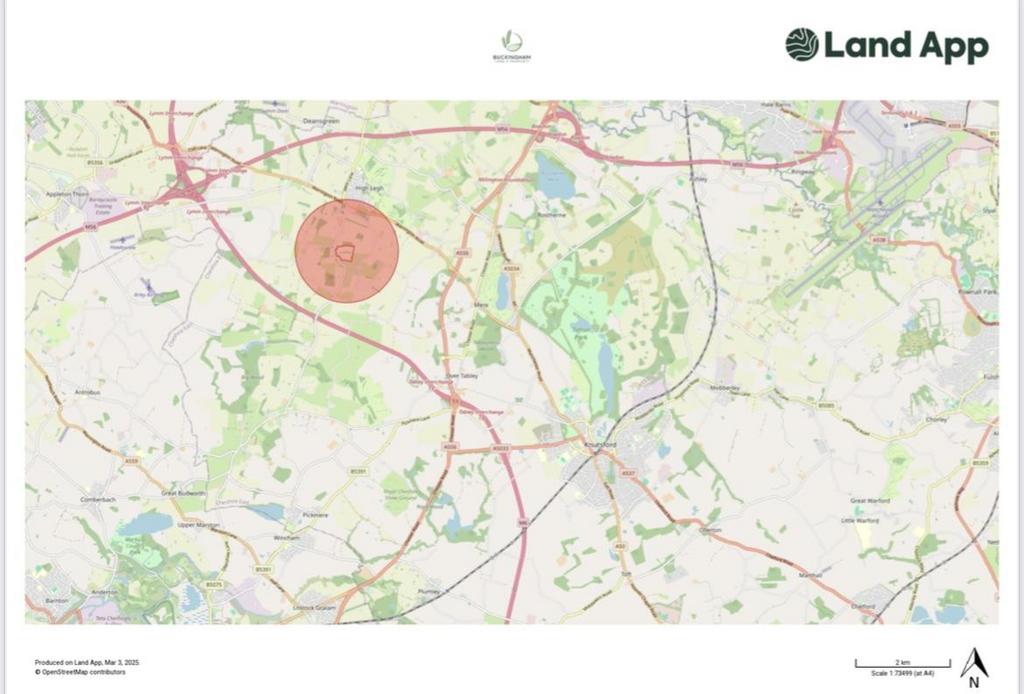
The land is located with frontage onto the adopted highway known as Rowley Bank Lane in High Legh and has gated access to each Lot. The village of High Legh is approximately 0.7 miles to the north, and the centre of Knutsford is approximately 5.6 miles to the southeast.
What3words: ///jumbled.paints.unearthly
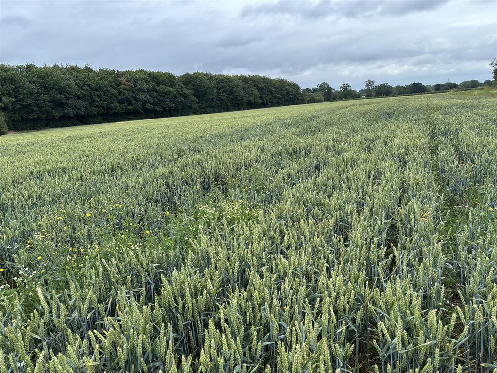
Lot 1
This field extends to approx. 12.24 acres and is edged blue on the sale plan. It is being used for arable cropping. A recent cropping history is available on request.
A footpath runs along the southern most boundary are shown on the sale plan.
The successful purchaser will be responsible for erecting and maintaining a stockproof fence (where there isn’t already one in place) along the boundary marked with inward facing T marks on the sale plan within 2 months of the sale completing.
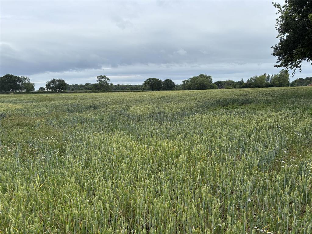
Lot 2
This parcel extends to approx. 13.12 acres and is edged red on the sale plan. It is being used for arable cropping. A recent cropping history is available on request. There is a small wood to the northmost boundary with several small ponds.
The land is located with frontage onto the adopted highway known as Rowley Bank Lane in High Legh and has gated access to each Lot. The village of High Legh is approximately 0.7 miles to the north, and the centre of Knutsford is approximately 5.6 miles to the southeast.
What3words: ///jumbled.paints.unearthly
Lot 1
This field extends to approx. 12.24 acres and is edged blue on the sale plan. It is being used for arable cropping. A recent cropping history is available on request.
A footpath runs along the southern most boundary are shown on the sale plan.
The successful purchaser will be responsible for erecting and maintaining a stockproof fence (where there isn’t already one in place) along the boundary marked with inward facing T marks on the sale plan within 2 months of the sale completing.
Lot 2
This parcel extends to approx. 13.12 acres and is edged red on the sale plan. It is being used for arable cropping. A recent cropping history is available on request. There is a small wood to the northmost boundary with several small ponds.
Property information from this agent
Area statistics
Crime score
Low crime
0/10
About this agent
Fazakerley Sharpe, one of the North West’s oldest privately owned property consultancies was initially established by Thomas Fazakerley in 1931. A measure of our ongoing strength and continued performance is exemplified by the number of original instructions from 1937 which continue to be managed by the business today. We pride ourselves on traditional values, the relationships we have built and a commitment to maintaining a personal service. We specialise in Residential, Commercial and Rural Practice covering the whole of the North West, but mainly in the Cheshire and Greater Manchester Areas. The Company operates from Wrightington Street in the heart of the historical town of Wigan, Lancashire and is now headed by Jack Sharpe, a Chartered Surveyor who is the 5th generation of the family to run the business and succeeds his late Grandfather, Brian Fazakerley.