No longer on the market
This property is no longer on the market
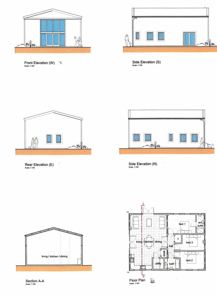

 Floorplan
3 bedroom barn conversion
Key information
Features and description
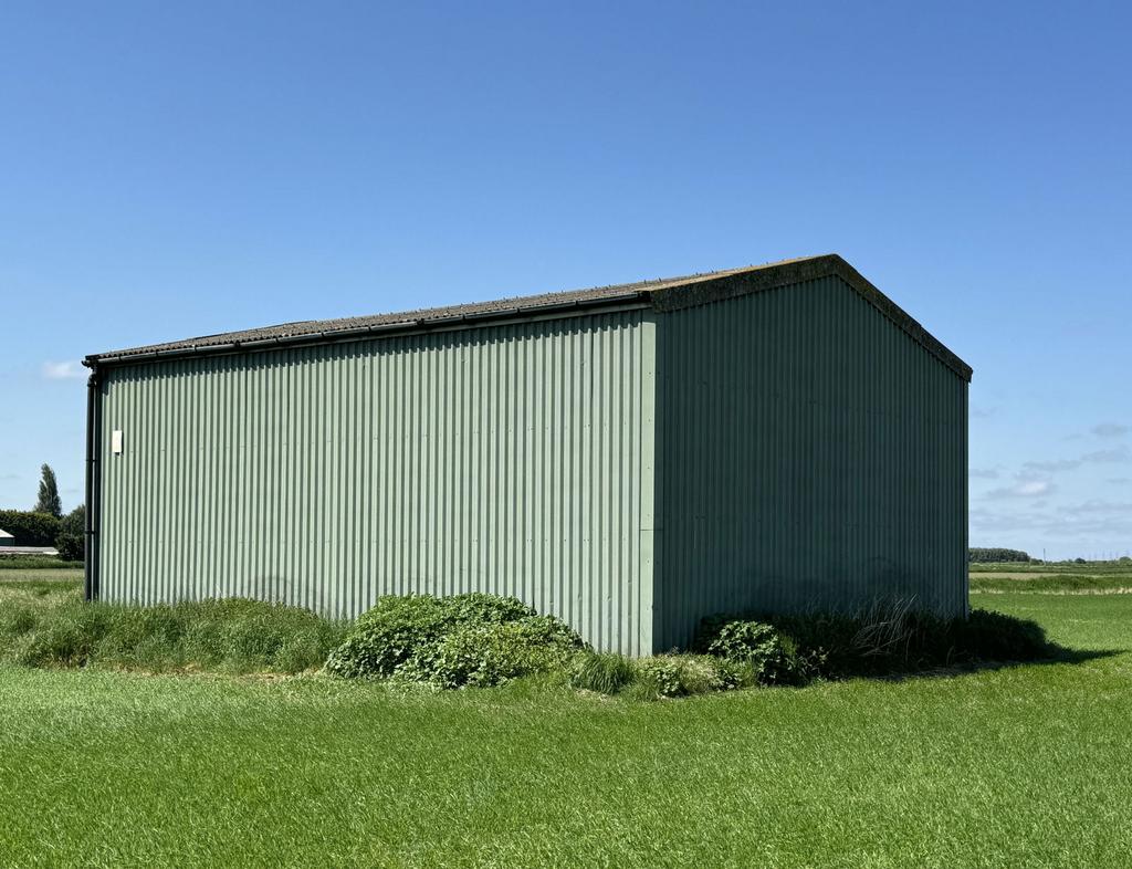
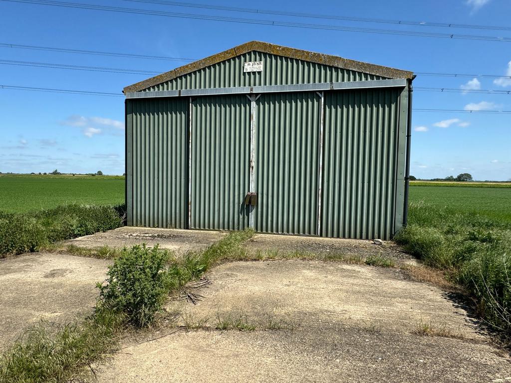
- Barn with Class Q Residential Conversion Consent
- Rural Location
- 6.00 Hectares (14.83 Acres) in total
- 104.3 sq m Barn
- Vacant Possession from 29th September 2024
- Available As a Whole or in Lots
LOCATION AND ACCESS The land is located north east of the junction of Angle Road and Mullicourt Road, Outwell and is accessible from the adopted highway via a gated access.
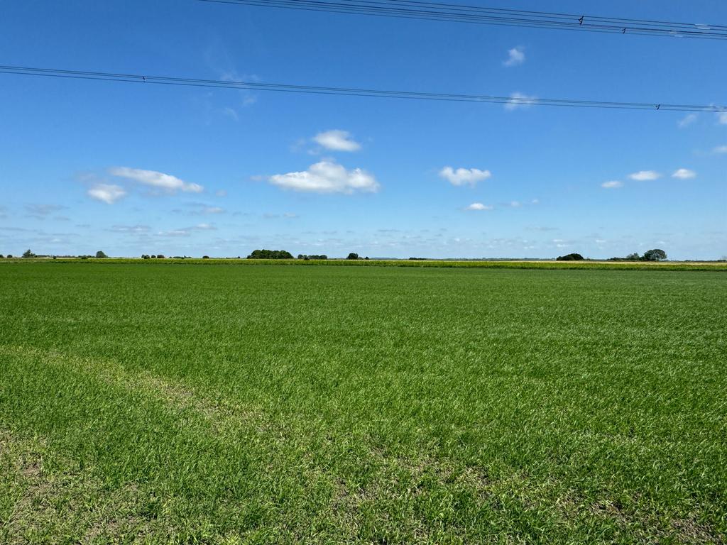
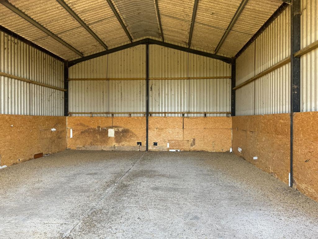
DESCRIPTION Field TF5304 4100 is a single parcel of land, currently arable, and extending in total to approximately 6.00 Hectares (14.83 Acres) (Subject to Measured Survey). Located on the eastern side of the land is an agricultural building of steel frame construction with concrete floor, profiled sheet steel walls and fibre cement sheet roof 12.0m x 8.7m (104.3 sq m Gross Internal Area) with a concrete apron extending along the western elevation of the building.
PLANNING Approval for a single residential dwelling under Class Q of the Town and Country Planning (General Permitted Development) (England) Order 2015 was confirmed by the Borough Council of King's Lynn and West Norfolk on 22nd March 2024 under Reference 24/00266/PACU3. The approved plans provide for a single storey dwelling comprising Open Plan Kitchen/Lounge/Diner, Utility Room, Cloakroom, Master Bedroom with En-suite Shower Room, two further Bedrooms and Bathroom. Copies of the plans are available on the Borough Council website or from the Agent. Whilst BCKLWN has adopted CIL, they have confirmed that this development will not require a CIL payment if carried out as currently approved.
LAND AND SOIL CLASSIFICATION The land is classified as Grade 1 on the Agricultural Land Classification Map of England and Wales Sheet 124. The soil is shown on the Soil Survey of England & Wales (Sheet 4 - Soils of Eastern England) as belonging to the Downholland 1 described as deep stoneless humose clayey soils, calcareous in places. Some peat soils and deep humose calcareous silty soils. The soil is deemed suitable for a range of arable and field vegetable crops. Interested parties are advised to make their own inspection of the land.
POSSESSION The land is offered For Sale Freehold, with vacant possession from 29th September, subject to holdover for the growing crop.
SPORTING RIGHTS Sporting rights insofar as they are owned and capable of being transferred are included in the sale.
BOUNDARIES The plan is for illustrative purposes only. The purchaser will be deemed to have full knowledge of all boundaries. The western boundary abuts an Internal Drainage Board maintained drain.
OUTGOINGS The land falls within the boundaries of the King's Lynn Internal Drainage Board which is administered by the Water Management Alliance. The current drainage rates are £204.34 per year but are subject to review as they are based upon a smaller area of land. Interested parties are advised to make their own enquiries of the Water Management Alliance at Pierpoint House, 28 Horsley’s Fields, King's Lynn, Norfolk PE30 5DD [use Contact Agent Button] [use Contact Agent Button]
MINERAL RIGHTS The minerals, in so far as they are owned and capable of transfer, are included in the sale.
PLANS AND AREAS These particulars have been prepared as accurately as possible, based upon Ordnance Survey plans. The plan has been prepared for Identification Purposes only and, although they are believed to be correct, their accuracy is not guaranteed. The area has been taken from a combination of the Land Registry and the Ordnance Survey online mapping system.
WAYLEAVES, EASEMENTS & RIGHTS OF WAY The land is offered subject to all existing rights, including rights of way whether private or public, light, support, drainage, water and electricity supply and other rights, easements, quasi easements and all wayleaves whether referred to or not in these particulars. The land is transected by an overhead power cable and there is a electricity tower in the field.
METHOD OF SALE The land is offered For Sale Freehold by Private Treaty.
VIEWING Viewing is strictly by appointment with the Agent. The Health and Safety of those viewing is the responsibility of the individual undertaking the viewing. Cultivated or uncultivated land is, by its nature, likely to be uneven with possible trip hazards. Neither the Seller nor the Agent accept any responsibility for damage or injury to persons or property as a result of viewing the land and parties do so entirely at their own risk.