


 Floorplan
Land
Premium display
Land
Key information
Features and description
- Agricultural Land
- 26.31 Acres (10.65 Hectares)
- Views to Exmoor
- Direct Road Access
- Open Fronted Barn & Pole Barn
- For Sale by Private Treaty
Pasture and improvable grazing land with two agricultural buildings adjoining the Crooked Oak stream. 26.31 acres (10.65 hectares). Direct road access. Open-fronted building and a Pole Barn. Mains water and electricity on site. Within walking distance of Knowstone. Views out towards Exmoor. For sale by private treaty.
Situation - The land lies in a quiet position adjoining the Crooked Oak Stream and the village of Knowstone is approximately 0.6 miles to the south. Access to the A361 (North Devon Link Road) is within two miles of the land. The market town of South Molton is 8.5 miles west of the land and Tiverton is 12 miles to the south-east.
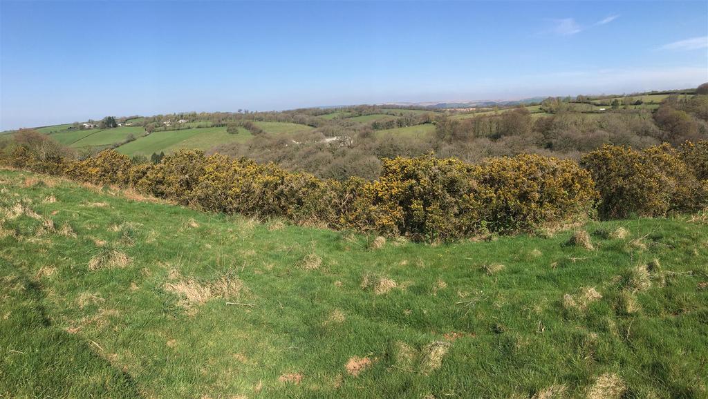
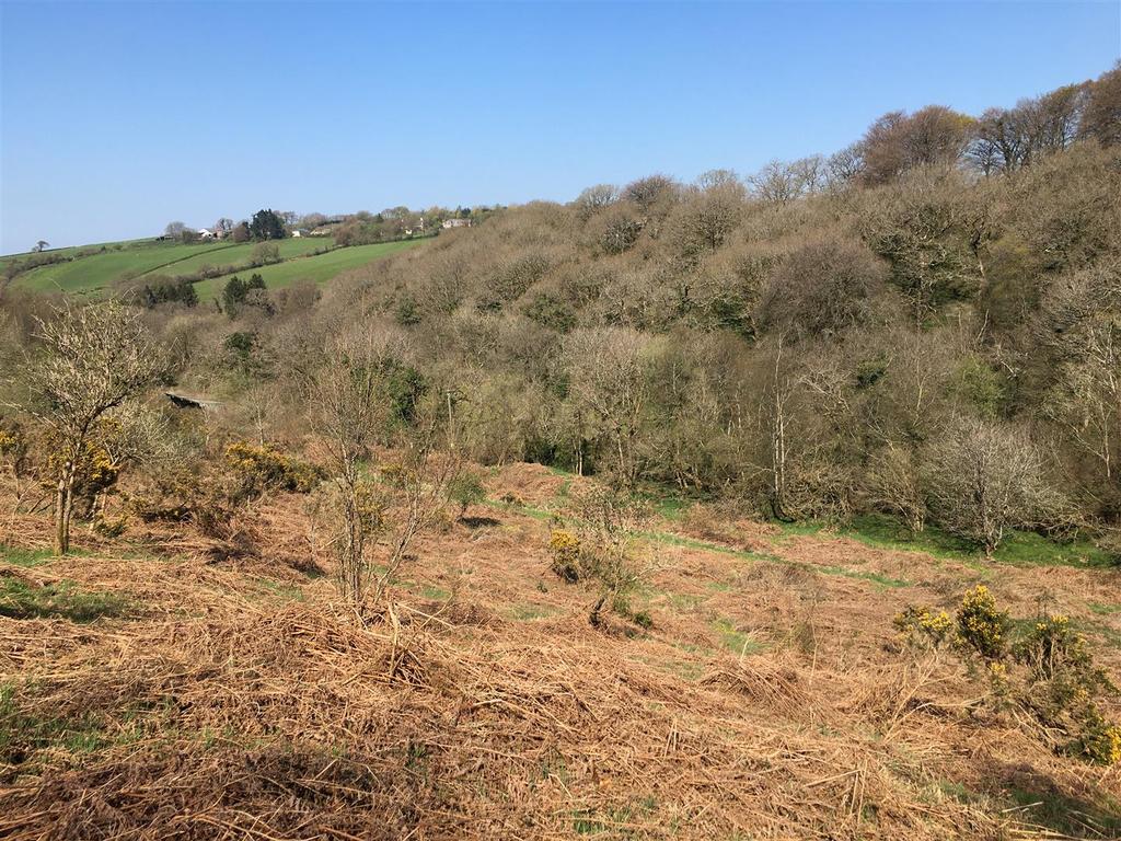
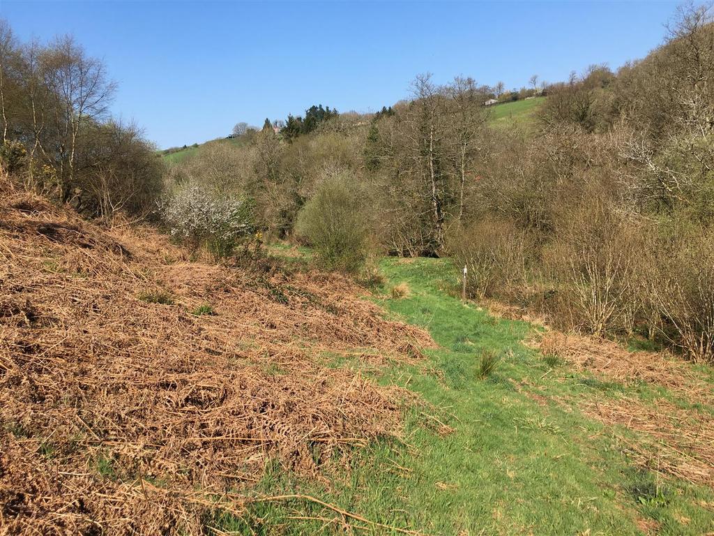
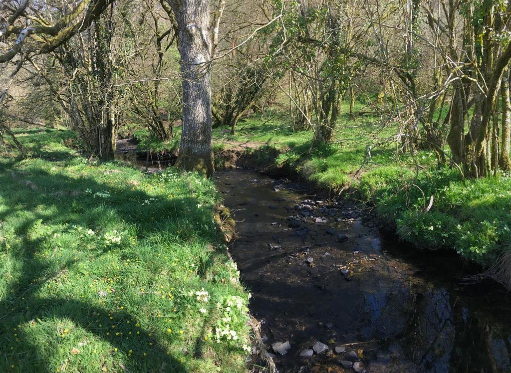
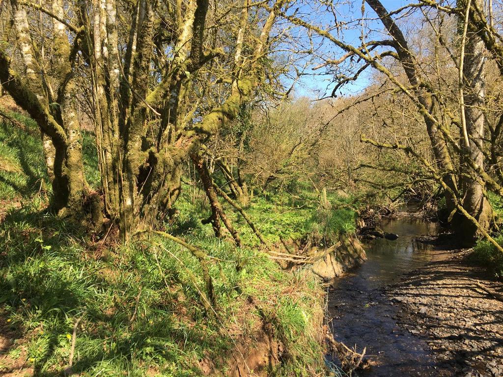
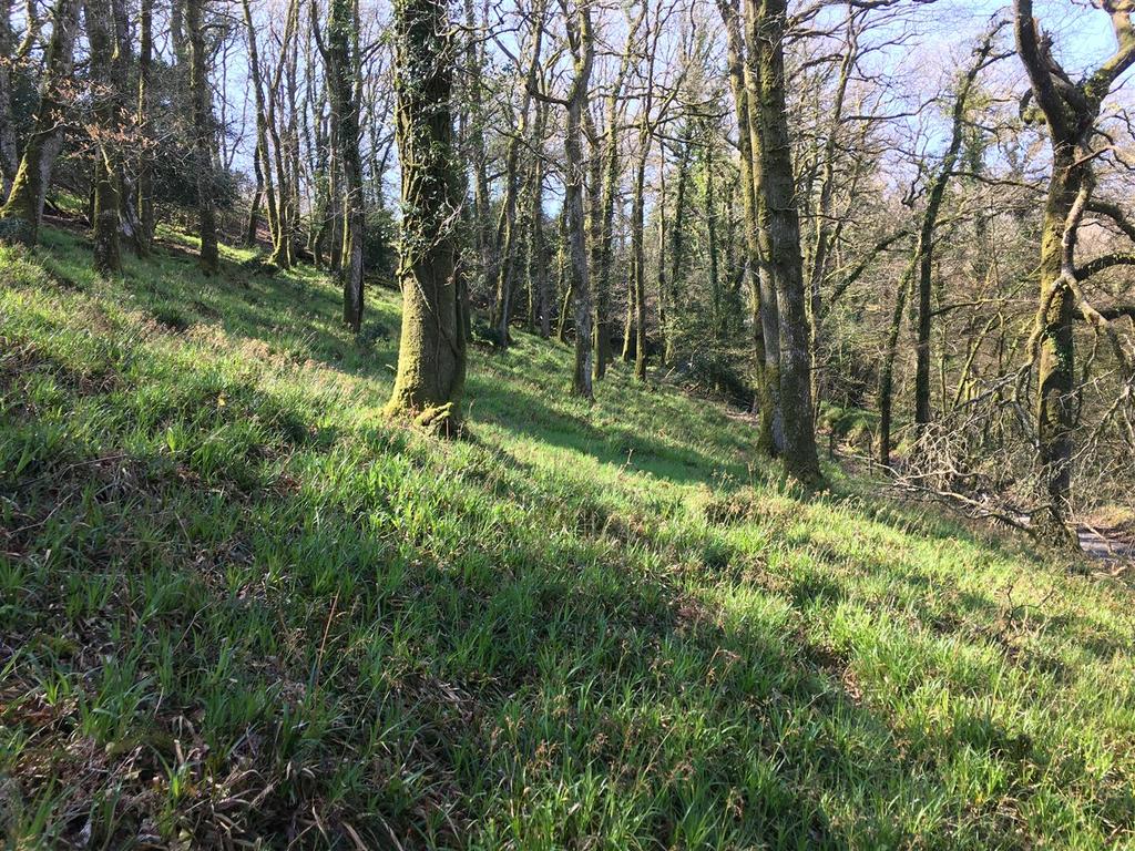
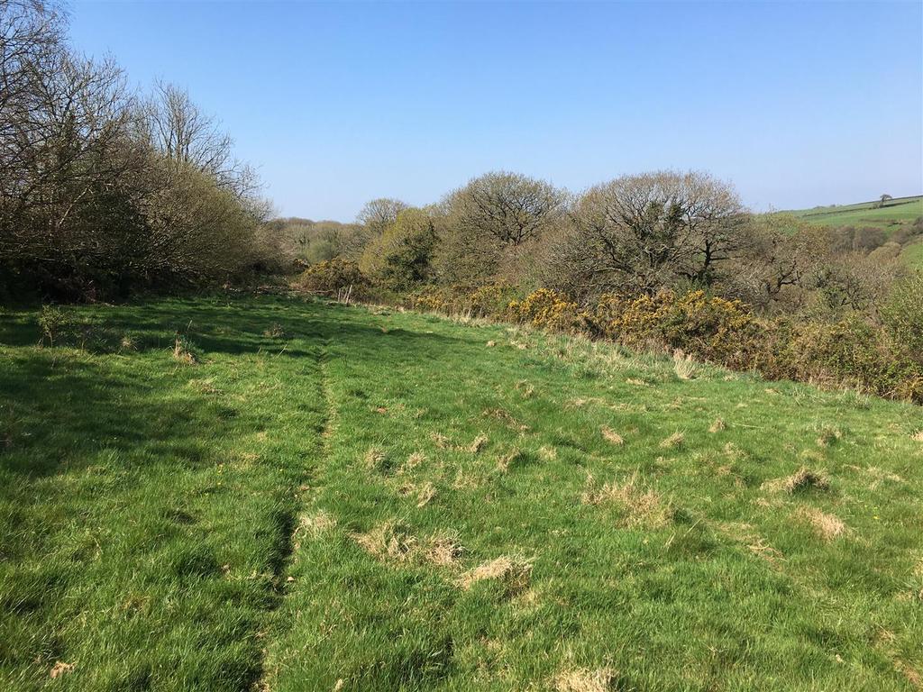
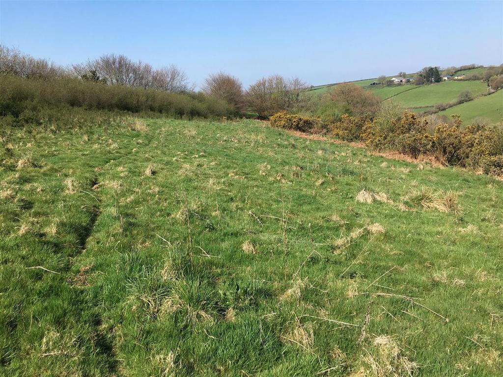
Description - The land is known as Penny Field and comprises a mixture of pasture land, improvable grazing land and woodland which adjoins the Crooked Oak stream. In total the land extends to 26.31 acres (10.65 hectares) divided into three main enclosures.
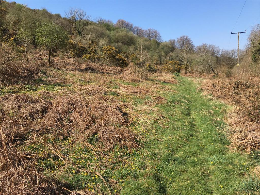
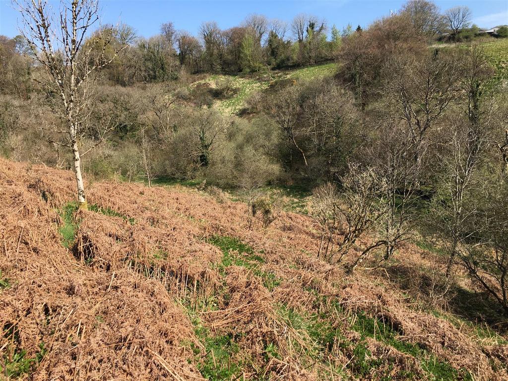
Offering a lot of conservation and ecological appeal, Penny Field is slopes from south to north, with more level and gently sloping areas adjacent to the southern boundary and the northern boundary adjoining the stream. There are areas of open pasture, a sloping bank of gorse and bracken and a small area of deciduous woodland near to the road.
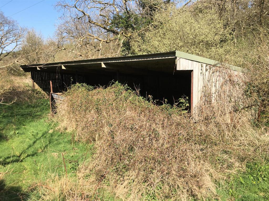
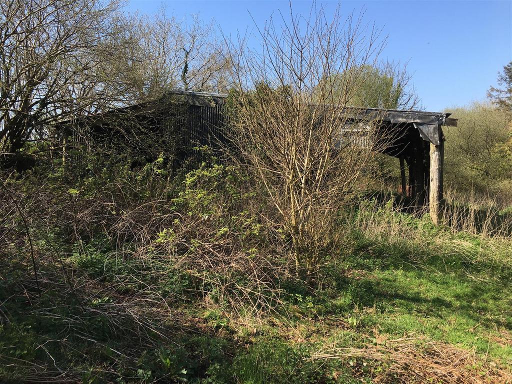
Within the land there is an OPEN-FRONTED BARN (18.28m x 6.00m) which has a steel frame with space boarded elevations and a box profile roof, near to which is a dilapidated former livestock shelter. There is also another POLE BARN (12.57m x 10.38m) and a smaller field shelter which are positioned towards to the south-western corner and two dilapidated mobile homes (no consent to be used for residential purposes).
Access - There is direct access to the land from a council maintained road with gateways on the western boundary.
Services - Both mains water (metered) and mains electricity are on site. Natural water is also available from the Crooked Oak Stream.
Method Of Sale - The land is offered for sale by private treaty, as one lot.
Tenure - The land is owned freehold and is registered on the Land Registry. Vacant possession is available on completion.
Basic Payment Scheme (Bps) - There are no entitlements available to be transferred with the land.
Designations - The land lies within a Nitrate Vulnerable Zone (NVZ).
Local Authority - North Devon District Council. [use Contact Agent Button]. ().
Sporting And Mineral Rights - The sporting and mineral rights insofar as they are owned are included with the freehold.
Wayleaves & Rights Of Way - The property is sold subject to and with the benefit of any wayleave agreement and any public or private rights of way that may affect it.
There is a public footpath passing through the land.
Land Plan - A plan which is not to scale, is included with these sale particulars for identification purposes only.
Viewings - All viewings are strictly by prior appointment with Stags. Please [use Contact Agent Button] or [use Contact Agent Button] to arrange an appointment.
Directions - From the Moortown Cross Junction on the A361 (North Devon Link Road) take the turn towards Knowstone, continue for 600 yards and turn left towards Knowstone. Upon reaching the T-junction within the village, turn left and continue out of the village. Upon reaching the next Junction (Wadham Cross) turn right signposted towards Molland and the land will be found on the right after a short distance.
Disclaimer - These particulars are a guide only and are not to be relied upon for any purpose.
Situation - The land lies in a quiet position adjoining the Crooked Oak Stream and the village of Knowstone is approximately 0.6 miles to the south. Access to the A361 (North Devon Link Road) is within two miles of the land. The market town of South Molton is 8.5 miles west of the land and Tiverton is 12 miles to the south-east.
Description - The land is known as Penny Field and comprises a mixture of pasture land, improvable grazing land and woodland which adjoins the Crooked Oak stream. In total the land extends to 26.31 acres (10.65 hectares) divided into three main enclosures.
Offering a lot of conservation and ecological appeal, Penny Field is slopes from south to north, with more level and gently sloping areas adjacent to the southern boundary and the northern boundary adjoining the stream. There are areas of open pasture, a sloping bank of gorse and bracken and a small area of deciduous woodland near to the road.
Within the land there is an OPEN-FRONTED BARN (18.28m x 6.00m) which has a steel frame with space boarded elevations and a box profile roof, near to which is a dilapidated former livestock shelter. There is also another POLE BARN (12.57m x 10.38m) and a smaller field shelter which are positioned towards to the south-western corner and two dilapidated mobile homes (no consent to be used for residential purposes).
Access - There is direct access to the land from a council maintained road with gateways on the western boundary.
Services - Both mains water (metered) and mains electricity are on site. Natural water is also available from the Crooked Oak Stream.
Method Of Sale - The land is offered for sale by private treaty, as one lot.
Tenure - The land is owned freehold and is registered on the Land Registry. Vacant possession is available on completion.
Basic Payment Scheme (Bps) - There are no entitlements available to be transferred with the land.
Designations - The land lies within a Nitrate Vulnerable Zone (NVZ).
Local Authority - North Devon District Council. [use Contact Agent Button]. ().
Sporting And Mineral Rights - The sporting and mineral rights insofar as they are owned are included with the freehold.
Wayleaves & Rights Of Way - The property is sold subject to and with the benefit of any wayleave agreement and any public or private rights of way that may affect it.
There is a public footpath passing through the land.
Land Plan - A plan which is not to scale, is included with these sale particulars for identification purposes only.
Viewings - All viewings are strictly by prior appointment with Stags. Please [use Contact Agent Button] or [use Contact Agent Button] to arrange an appointment.
Directions - From the Moortown Cross Junction on the A361 (North Devon Link Road) take the turn towards Knowstone, continue for 600 yards and turn left towards Knowstone. Upon reaching the T-junction within the village, turn left and continue out of the village. Upon reaching the next Junction (Wadham Cross) turn right signposted towards Molland and the land will be found on the right after a short distance.
Disclaimer - These particulars are a guide only and are not to be relied upon for any purpose.
Property information from this agent
About this agent
Stags South Molton office is easily found in the main Town Square. As the leading estate and letting agent in South Molton the highly successful team work alongside the agriculture department who conduct a weekly livestock market. The A361 (North Devon Link Road) bypasses the town and provides excellent access to Barnstaple, to the west, and Tiverton and the M5, to the east. South Molton is a small but highly regarded North Devon market town. The weekly thriving sheep and cattle livestock market is on Thursdays. Tourism plays an important part in the economy of South Molton, which is ideally positioned within easy reach of Exmoor, Dartmoor, the rugged north coast and beautiful sandy beaches to the west. The town has remained largely unspoilt, containing many interesting buildings from different periods, including Medieval, Elizabethan and Georgian properties. A heritage trail guides visitors around the town's historic sites.